- Thumbnail
- Resource ID
- 223d5ecc-6f6b-11e9-8d7d-000d3ab6a624
- Title
- TM-BRB_Seagrass Beds - 1997 - 1:5000
- Date
- May 5, 2019, 2:22 p.m., Publication
- Abstract
- This dataset shows the seagrass beds around the south and west coast of the island .This data was provided by the Coastal Zone Management Unit of Barbados ca.1997.
- Edition
- --
- Owner
- gridanode
- Point of Contact
- devrsgis@gmail.com
- Purpose
- --
- Maintenance Frequency
- None
- Type
- not filled
- Restrictions
- None
- None
- License
- None
- Language
- eng
- Temporal Extent
- Start
- --
- End
- --
- Supplemental Information
- No information provided
- Data Quality
- --
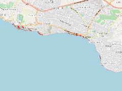
- Extent
-
- long min: -59.5819036591
- long max: -59.5302793548
- lat min: 13.0458966153
- lat max: 13.0702803204
- Spatial Reference System Identifier
- EPSG:900913
- Keywords
- no keywords
- Category
- None